Exploring the Hidden Masterpieces at the Vatican’s Gallery of Maps
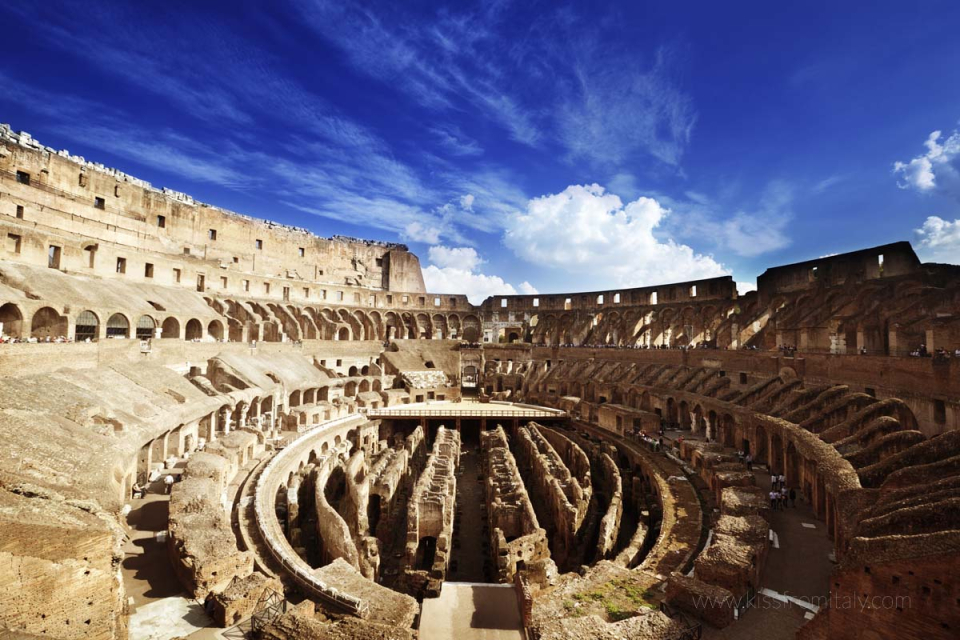
Tourists heading to Rome can’t leave without visiting one of most impressive artistic, cultural and religious sites in the world: the Vatican. While anticipating the grandeur of St. Peter’s Basilica and the Sistine Chapel, don’t overlook the other treasures that pack the halls of the Holy See’s Museums. From pagan Roman statues to contemporary Christian art, the Vatican is brimming with a selection of paintings, sculpture, tapestries, furniture and frescos that reflect the artistic and cultural heritage of the Western world.
The Gallery of Maps: A Journey Through Time
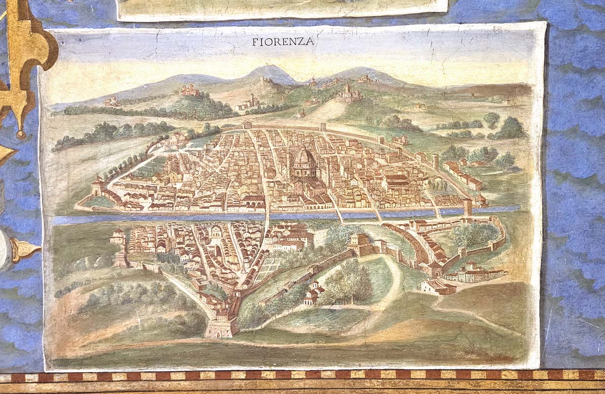
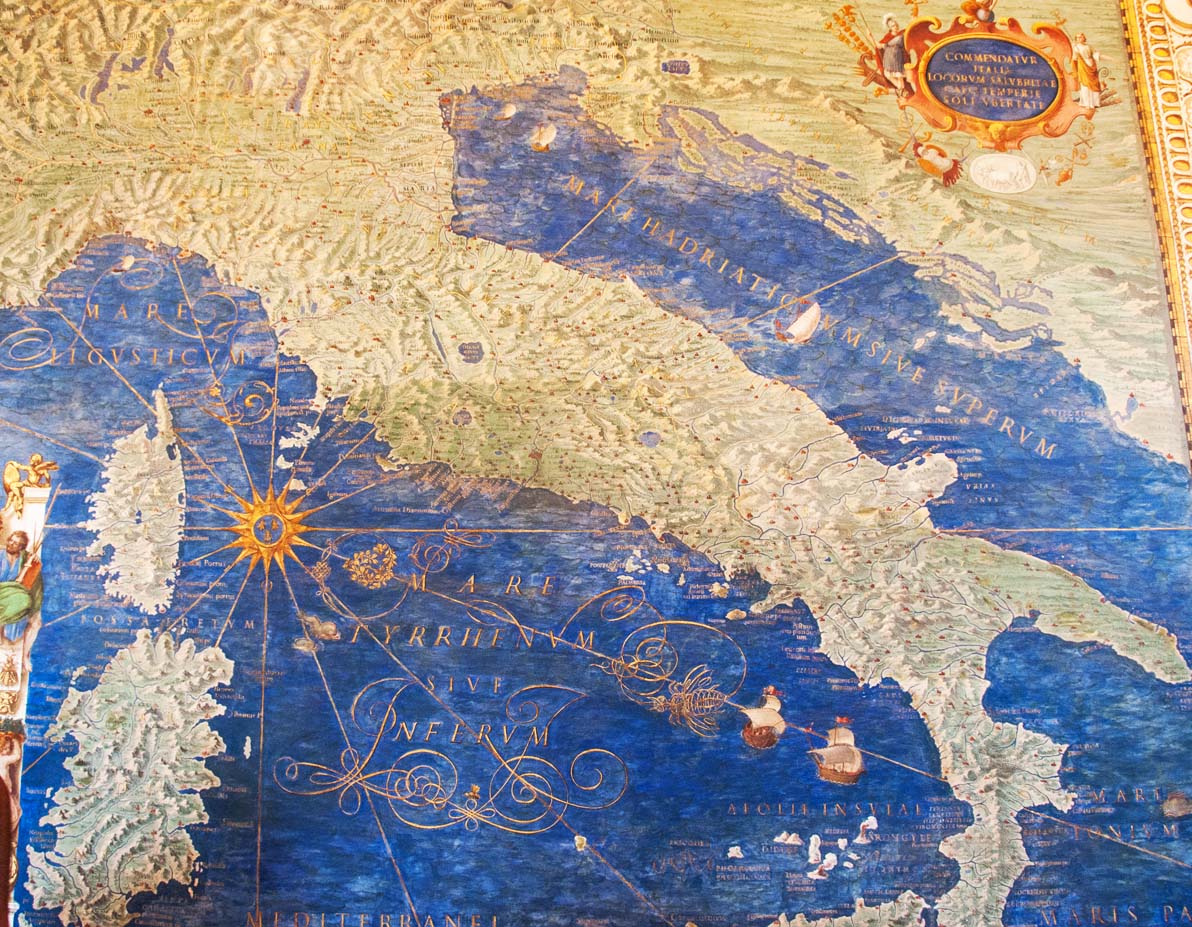
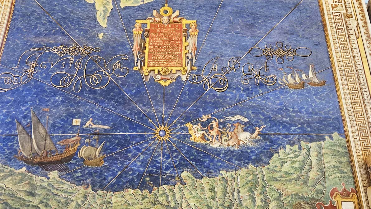
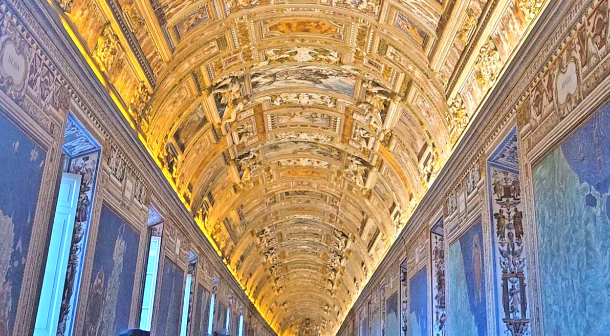
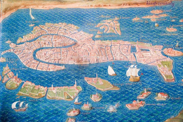
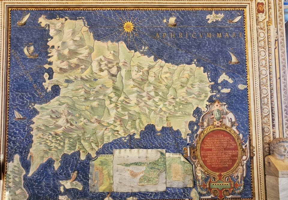
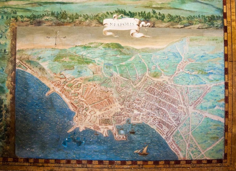
While visiting the Vatican Museums, sightseers amble through many breathtaking halls before ascending into the famed Sistine Chapel. One of the most opulent and impressive corridors is undoubtedly the Gallery of Maps, which extends for 120 meters and houses the largest cycle of geographical paintings ever created. The sixteenth century pope, Gregory XIII, commissioned these forty geographical frescoes that depict Italy and Italian provinces. Their sheer size (the frescos nearly stretch from the ceiling to floor) impresses, as their incredible detail draws viewers in. Snow capped mountains, whimsical boats, fabulous sea creatures and even the mythological god of the sea, Neptune, are snuck into these elaborate maps, like an olden-day Where’s Waldo.
Mapping Italy: Historical Insight and Accuracy
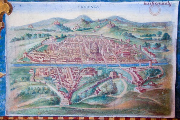
Visitors entering the gallery will observe that the first maps portray contemporary and ancient Italy. Although the maps’ scaling may be a bit off, consider the accuracy for the 1500s! At the time, Italy was a hub for navigation and cartography as one can tell by the detail. Strolling down the hall, the maps then depict the Italian provinces, major islands and Avignon. Avignon once reigned as the papal seat from 1309-1377, when seven successive popes ruled from this southern French town instead of in Rome. At the end of the gallery, hang paintings of several Italian islands and of Italy’s four main ports: Civitavecchia, Ancona, Genoa and Venice. The paintings are further arranged based on their location in the Italian peninsula. Cities and lands to the west of the Apennine mountain range are on the west side of the gallery, while those to the east towards the Adriatic Sea are on the east wall.
The Artistry of Ignazio Danti
The maps were based drawings by the Dominican monk and illustrious geographer and cartographer, Ignazio Danti. A large workshop frescoed these full-size illustrations throughout the long corridor a relatively short time (1580-1581). Although the paintings look well kept and colorful, they had to undergo several restorations starting from the 1600s.
An Artistic and Mythological Blend
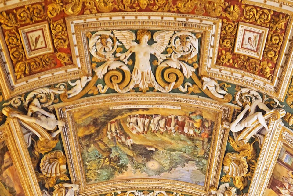
What makes the room truly elegant and sets the scene, are the seventeen sumptuous paintings framed in elegant stucco and Latin inscriptions that line the corridor’s vaulted ceiling. These colorful works show scenes from the history of Rome and the early Papacy. Admire the baptism of Constantine, the battle of the Milvian Bridge or the meeting of Emperor Barbarossa with Pope Alexander III. Curiously, among historical religious scenes are also images of mythology. The Papacy’s tendency to intertwine the Pagan world with the Christian was a mode for the Pope to express his secular and spiritual supremacy.
Ancient Time GPS
While modern technology allows us to carry digital maps in our pockets, the artistry and craftsmanship of these historical maps offer an entirely different kind of navigation experience. Visitors often find themselves transported back in time, marveling not only at the aesthetic appeal but also at the historical insights these maps offer into 16th-century geography and politics.
Experience the Gallery of Maps
So, next time you’re touring the Vatican, be sure to pause and closely examine these precious maps. Whether you’d like to scrutinize the scientific cartography skills of the 1500s, admire the artistic techniques, reflect on the religious ceiling scenes, or play the ultimate game of I-Spy, the Gallery of Maps is one of the Vatican’s countless gems that will leave visitors in awe.
Practical Tips for Visiting the Gallery of Maps
In order to visit the Gallery of Maps you will need the general admission ticket to the Vatican Museums. To make the most of your visit, plan to arrive early in the morning or later in the afternoon to avoid crowds. Comfortable shoes are recommended as the Vatican Museums involve a lot of walking, and the floors can be uneven. Book your tickets online in advance to skip long lines, and take advantage of guided tours to gain deeper insights into the history and artistry of the gallery. The Vatican is for sure a place where a private tour will make a huge difference: you will see more, avoid wasting time and have a much more interesting and enjoyable experience. Lastly, take your time to slowly enjoy the frescoes and historical scenes—this is a space where patience and curiosity will greatly enhance your experience.
For a private tour of the Gallery of Maps and Vatican Museums see here. We can make it customized to fit your wishes and schedule, just contact us for more information
Gallery
View all 7 photos